Features of Deposition
By Alex Jackson
Last updated on
In a coastal environment, deposition results in the accumulation of sediment along or near a coastline. This happens when the forces responsible for transporting sediment in a coastal environment weaken and can no longer support the sediment. Depending on how and where the sediment is deposited, a variety of landforms can be produced.
Spits
A spit is a stretch of sand or shingle extending from the mainland out to sea. They develop where there is a sudden change in the shape of the coastline such as at a headland. Normally, longshore drift transports beach sediment along a coastline. When the shape of the coastline changes substantially however, longshore drift continues to transport material in the same direction rather than following the coastline. This transports the material out to sea. As the strength of the drift weakens away from the coastline, the sediment is deposited. Deposition can be brought about earlier near estuaries. The flow of water into the sea at an estuary is stronger than the drift, forcing the sediment to be deposited.
The deposition of sediment forms a spit but its shape changes as a result of wave refraction. Refraction around the end of a spit curves it into a “hook” forming a recurved spit. As the area behind a spit is sheltered from waves and the wind, it provides the perfect environment for salt marshes to develop.

Spits are eroded by the sea and wind but a constant supply of sediment from longshore drift ensures their continued existence. Events such as storms change the shape of a spit drastically over short periods of time though. During a storm event, erosion exceeds deposition so a lot of material is removed from the spit, changing its shape.
Using Google Earth or Google Maps, it’s possible to see the shape of different spits from an aerial perspective. Spurn Head in Yorkshire is a good example. Google Earth has the added ability to look at past images of an area. Using this feature, you can see how many of Britain’s spits have changed with time.
Bars
If the bay between two headlands is blocked off by a spit then that spit is known as a bar. The body of water behind the bar is known as a lagoon.
An example of a bar is Slapton Ley in Devon. Again, it’s possible to see this landform using Google Maps.
Tombolos
Sometimes a spit extends far enough out to sea to join a coastal island to the mainland. When it does so, the spit is known as a tombolo. An example of this is Chesil Beach which joins the Isle of Portland to the south of mainland Britain.
Haloseres & Salt Marshes
Need an example of a salt marsh? Parkgate’s a good one. It’s located in the Wirral and has delicious ice creams.
A halosere is an ecological succession that develops in a highly saline environment. Guess where you find lots of salt? That’s right, the sea. Haloseres are nearly always found along coastlines with the most common type of halosere being a salt marsh.
People tend to have a love-hate relationship with salt marshes. Some people—namely scientists and bird watchers—love them because they provide a habitat for many rare and endangered animals. Other people hate them because they’re a nuisance to shipping. Regardless of whether or not you like them, they’re important coastal landforms that provide an effective and sustainable method for defending a coastline from erosion.
Formation
Salt marshes only form in low energy environments where there is shelter from the wind and waves. Depositional landforms such as spits can help provide this shelter. Salt marshes require a large input of sediment which can arrive from the sea and rivers. The most likely place along a coastline where you’ll find this sort of sediment input is near a tidal flat. The low gradient of a tidal flat means that any rivers that flow into it will very quickly deposit any sediment they’re transporting. At the same time, the periodic flooding of the tidal flat by the tides will deposit even more sediment.
Over time, sediment accumulates and the elevation of the tidal flat increases in a process known as coastal accretion. This reduces the duration of tidal flooding allowing a small selection of plants to grow on the now developing salt marsh. These plants are halophytic—they love salt—and are capable of surviving underwater for several hours a day. They’re often called pioneer species because of their hardy nature and, well, pioneering growth on salt marshes. These plants, which include species of cordgrass (Spartina) and glasswort (Salicornia)1, have several adaptations that not only help them thrive in saline environments but also help aid coastal accretion.
Long blades of cordgrass trap sediment that is too fine to settle out of water in a salt marsh, building up a muddy substrate. At the same time, the roots of the cordgrass plant (that are long to tap into the water table) help stabilise already deposited sediment, aiding coastal accretion. Pioneer species such as Spartina alterniflora (a species of cordgrass) are invasive plants that spread rapidly. Once these plants are introduced to a salt marsh, coastal accretion takes place quickly and the elevation of the salt marsh increases greatly. This creates new environments that are submerged by the tide for shorter periods of time, allowing even more species of plants and animals to colonise the salt marsh.
The Attack of the Salt Marshes
Salt marshes are great. They produce some lovely scenery, create a habitat suitable for many rare creatures and they’re a natural coastal defence. Unfortunately, they do have some problems which have earned them a bit of a bad name.
As we’ve discussed, salt marshes form in places sheltered from the sea. This is the same place where people like to build ports for boats. In case you can’t see where this is going, salt marshes like to develop where people like to sail. This is a problem because boats don’t play nicely with long plants that get stuck in propellers.
In the past, salt marshes have grown uncontrollably and caused major economic changes to the areas in which they’ve grown. Parkgate—a small village on the Wirral Peninsula—was a major shipping port for the United Kingdom. As the River Dee’s Estuary (onto which Parkgate sits) silted up however, shipping became less feasible and the area instead became a somewhat popular seaside resort thanks to the newly forming beaches. This didn’t last though. Throughout the nineteenth and early twentieth century grass began to grow on the beaches and a salt marsh developed. The salt marsh’s existence was made permanent when the invasive Spartina anglica—an Anglo-American hybrid—rapidly grew across the salt marsh and increased silting ten-fold.
Nowadays Parkgate is a small tourist area in the Wirral, known for its ice cream. The salt marsh is still around and is protected by the RSPB because of the large number of nesting birds living in it. Unfortunately, some scumbags delinquents set fire to the marsh in April 2013, killing many rare nesting birds.
The Revenge of the Humans
Since salt marshes are bad for business, people try to stop them from developing. It’s not uncommon for people to engage in cleansing sessions where they try and remove plant species that are growing on a salt marsh and aiding coastal accretion. This slows the salt marsh’s growth enough for it to not be a problem but it doesn’t totally stop it.
Once a salt marsh has fully developed they’re pretty damn hard to get rid of. Invasive species of plants like Spartina are difficult to eradicate and populations can rebound from just a small number of plants. As a result, once a salt marsh has developed, it’s better to see what a salt marsh can do for you rather than trying to destroy it. After all, you have some new land. Why not build on it? Many cities across the globe have encroached onto salt marshes. Sure urban development kills pretty much anything living on the salt marsh but hey, free land!
Aside from humans building on salt marshes, our agricultural activities also threaten them. If it is first drained, cattle can be herded on a salt marsh. This impacts the salt marsh ecosystem as cattle selectively eat certain plants, reducing biodiversity. In addition, run off from fertiliser used on farmland can enter salt marsh ecosystems. The fertiliser mixes with water in the salt marsh leading to eutrophication taking place. This is where the fertiliser acts as a fertiliser for phytoplankton in the water and causes populations of phytoplankton to greatly increase. These phytoplankton blooms block out sunlight at the surface of the water, preventing aquatic plants from photosynthesising. In addition they remove oxygen from the water creating an anoxic environment unsuitable for many aquatic animals.
The Revenge of the Humans Against the Humans Who Are Getting Revenge on the Salt Marshes
Rest assured, there are people out there who want to protect salt marshes. Unfortunately there isn’t a lot we can do besides introducing land use laws around salt marshes. To reduce the risk of eutrophication we can prevent the development of farmland near a salt marsh. This could have a limited effect though as once agricultural waste enters the water system, it’s probably going to end up in a salt marsh.
Laws can be introduced to stop people from trying to destroy developing salt marshes but many of the “cleansing sessions” people engage in have the backing of local councils. Similarly, trying to get people to stop building on marshes could be difficult as local governments may actively encourage development to ease land pressure.
The best we can do is turn the salt marshes into SSSIs (Sites of Special Scientific Interest). This would make it illegal for people to build on or damage salt marshes. Several marshes around the UK—including Parkgate—have been designated SSSIs because of the number of rare birds and plants that live on them.
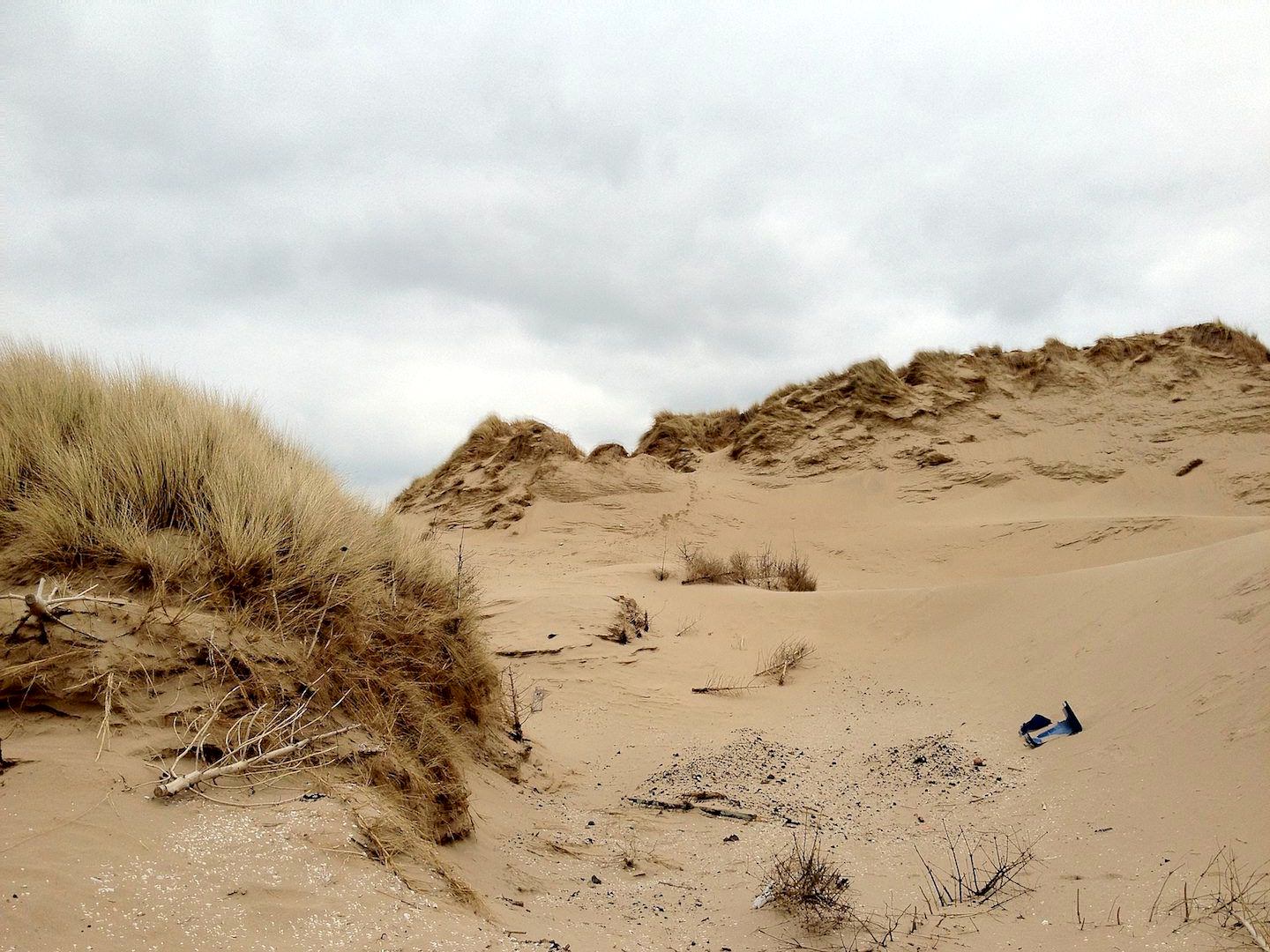
Sand Dunes & Psammoseres
A psammosere is an ecological succession that develops in the sands of a coastal environment. Nine times out of ten, they develop in sand dune successions. As you move inland across a sand dune succession, the environmental conditions—in particular the soil’s pH2—change. This change in conditions causes the species of animal and plant life found in the succession to also change.
Formation
There are several conditions that need to be met for sand dunes to develop. First, a large supply of sediment is needed. The best place to get this is from a large tidal flat. An area with a large tidal range (a big difference between the high and low tide) will result in a lot of sand being exposed to the wind, ready to be transported. This brings us to our next condition. A (relatively) strong and continuous wind is needed to move sand grains and transport them inland via saltation. The best place to find strong winds that don’t change direction is in areas that face the prevailing wind direction.
With these conditions met, it’s now only a matter of time until a sand dune starts to form. Obstacles such as rocks or human rubbish are deposited at the strandline—essentially the high water mark. These objects block the wind causing sand grains that are being transported to be deposited. Over time, the sand grains will build up and encompass the object forming a very small embryo dune.
Eventually pioneer species of plants will start to grow on the embryo dune. As they do so, they bind the sand together, increasing the stability of the dune. The vegetation itself also traps sand causing the embryo dune to grow even more. As the dune grows it becomes a foredune and a new embryo dune begins to develop in front of it. This is the beginning of a sand dune succession.
Parts of a Sand Dune Succession

A transect across an idealised sand dune succession. Note that it is not to scale.
Embryo Dunes
As we’ve already discussed, embryo dunes are the first part of a sand dune succession. They form in the shadow of obstacles at the strandline. As sand is deposited, pioneer species such as prickly saltwort (Kali Turgida) colonise the embryo dune and begin to bind the sand together.
The conditions on embryo dunes are harsh so plants have to have special adaptations to colonise them. The pH of the soil (which is essentially sand at this point) is very high (~8–8.5). This is because of the large number of marine shells deposited in embryo dunes. The shells are made from the mineral calcite (and sometimes aragonite3) which is also known as calcium carbonate. Calcium Carbonate is an alkaline and so as it is broken down in the soil, it increases its pH.
The high pH limits plant growth to only very hardy species. Growth is further limited by the high salinity of the soil and the lack of fresh water. At the strandline, plants won’t be submerged by the sea but they will be splashed by it and so they have to be halophytic (salt tolerant). The lack of fresh water means they need to have long roots to reach the water table. These long roots help stabilise the embryo dune.
Foredunes/Yellow Dunes
The vegetation that grows in an embryo dune trap sand in their stems and help stabilise the embryo dune. This causes the embryo dune to grow until a new embryo dune starts to form in front of it. At this point, our old embryo dune becomes a foredune. As the dune is still composed mainly of sand, foredunes are also called yellow dunes because of their yellow colour. To make things even more confusing, because the sand is still relatively un-compacted these dunes, along with embryo dunes, are also called mobile dunes.
Because of the pioneer species that lived on the embryo dune, conditions have changed in the foredune and they’re now more hospitable to life. The vegetation on the embryo dune has decreased the soil’s pH. The soil is still alkaline (pH ~7.5–8) but it is now tolerable to a wider range of plants. Marram grass often grows in foredunes. Like prickly saltworth, marram grass is a halophyte and has long roots to tap into the water table. These roots again help bind the sand, increasing the foredune’s stability. Marram grass grows tall very quickly though. This means that the plant can trap a lot of sand without burying itself in sand, allowing the foredune to grow quite big.
Marram grass has an interesting adaptation for living on foredunes. As it is quite long, to reduce damage from the wind it is made from very thin blades. This makes it more aerodynamic but reduces how much rainwater it can collect. To combat this, during light winds its blades fold outwards to collect more water. Then, as the wind picks up, the blades fold in to protect them from the wind.
Grey Dunes
As the plant life on a foredune dies, it forms a layer of humus (not the same thing as hummus). This is an organic layer of soil that is somewhat acidic and helps lower the pH of the soil to ~6–7. The higher organic content of the foredune gives it a grey colour and it is now known as a grey dune. As the soil is now more stable, it is also known as a fixed dune.
The lowered pH allows some new species of plants to develop. Vegetation such as marram grass will still prevail though as grey dunes are still dry and exposed to the wind. The really interesting vegetation grows in dune slacks.
Dune Slacks
Dune slacks are very large depressions in sand dune successions that are often deep enough to expose the water table. There are two ways they can form. If a foredune grows large enough it can form a dune ridge that prevents any further deposition of sediment inland by blocking the wind. The low point behind the ridge is the dune slack. Since there’s little erosion taking place behind the dune ridge, the water table generally isn’t exposed in the dune slack.
The more interesting dune slacks form as a result of blowouts. Excessive trampling and grazing of plants on a dune will reduce the stability of the dune since there’s no roots to bind it together. This makes it easier to erode the dune, producing a deep depression in the succession that often reaches down to the water table.
As fresh water is exposed at the surface, new types of vegetation can grow in the dune slack, in particular reeds and rushes. A dune slack that forms behind a grey dune often contains a variety of vegetation because the humus on the grey dune is blown into the dune slack making it even more hospitable.
Climax
The climax (or plagioclimax) marks the end of the sand dune succession. Here, soil pH is much more acidic (~4.5–5) thanks to a thick layer of humus developing. This allows vegetation like shrubs and trees to grow. Often forests develop at the climax of a sand dune succession.
Note that if the end of a sand dune succession is bought about due to human activity, the end is known as a plagioclimax.
Sand Dune Protection
Sand dune successions are fragile systems and are susceptible to damage and interference from humans. We therefore take it upon ourselves to protect sand dune systems and we do so using a variety of methods. Many of the methods used are soft engineering techniques so they are low cost, low technology and work with nature rather than against it.
Sand dunes, more specifically the vegetation that covers sand dunes, are often trampled by humans and grazing animals. This creates the conditions needed for a blowout. In order to limit trampling and prevent blowouts, sand dune management takes place and restricted access is granted to areas of sand dune successions. Footpaths are constructed to limit the trampling of plants to certain areas and these footpaths are fenced off in order to prevent people from wondering off onto sand dunes. Some types of footpaths, known as boardwalks, are made of wooden slats which allow plants to grow underneath the boardwalks and therefore continue to bind the sand in that particular area.
Educating tourists is a particularly effective way of reducing damage to sand dunes. Information boards will limit the number of tourists who simply ignore the “no access” signs by actually providing them with a reason to obey them.
In order to stabilise sand dunes, dead fern trees can be planted in the sand to help trap the sand and build up new sand dunes. These trees can also be used to stabilise existing sand dunes allowing them to grow to great heights.
Dead pine trees planted at Formby Sand Dunes have increased the sand dunes' stability causing them to grow very big
- Those are some scary looking Latin names. Don’t worry about knowing them for the exam, just knowing the common name is enough.↩
- The pH of soil (or anything else for that matter) is a measure of how acidic or alkaline it is. A pH < 7 would indicate that the soil is acidic. A pH > 7 would indicate that it is alkaline. A pH of 7 would indicate that it is neutral.↩
- Aragonite and Calcite are both crystalline forms of calcium carbonate (CaCO3). Aragonite is less common than calcite because it’s less stable over long periods of time and often reforms as calcite. Still, it’s found in most mollusk shells and some corals and in the timescales involved in dune creation, it will still be quite common.↩